
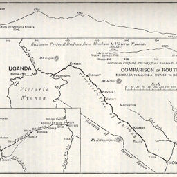
Comparison of Routes Mombasa to Uganda-Suakin to Berber
Permalink
https://digital.library.illinois.edu/items/57865cb0-e946-0133-1d3d-0050569601ca-c
This item is in the public domain.
Descriptive Information
| Title | Comparison of Routes Mombasa to Uganda-Suakin to Berber |
| Creator | Manchester Geographical Society |
| Date | 1894 |
| Dimensions | 10.2 x 12.8 cm |
| Place of Publication | England |
| Cartographic Scale | 1:9,000,000 |
| Notes | Includes elevation profile of the Mombasa-to-Uganda route and 1 inset map showing the Berber-to-Suakin route. |
| Coverage-Spatial | Sudan |
| Subject | |
| Genre | Maps |
| Language | English |
| Color | Bitonal |
| Technique | Lithography |
| Source | The Journal of the Manchester Geographical Society, V. 10, p. 117. |
| Physical Location | stx |
| Map No. in Bassett and Scheven Bibliography | 1465 |
| Call Number | 910_6MA |
| Map ID | afm0001465 |
| Rights | No Copyright - United States |
| Rights Description | This item is in the public domain. |
| Collection Title | Maps of Africa to 1900 |
| Repository | Rare Book & Manuscript Library |
| Type | Cartographic material |
| Collection | Maps of Africa to 1900 |
Download Options
|
Comparison of Routes Mombasa to Uganda-Suakin to Berber |
Contact us
for questions and to provide feedback.