


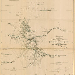
Darstellung der hauptsächlichsten Constructions-Elemente für die Karte des Nord-Östl. Kenia-Gebietes...
Permalink
https://digital.library.illinois.edu/items/57b50a70-e946-0133-1d3d-0050569601ca-8
This item is in the public domain.
Descriptive Information
| Title | Darstellung der hauptsächlichsten Constructions-Elemente für die Karte des Nord-Östl. Kenia-Gebietes... |
| Creator | Chanler, William Astor, 1867-1934 |
| Date | 1894 |
| Dimensions | 61.5 x 49.5 cm |
| Place of Publication | Germany |
| Cartographic Scale | 1:750,000 |
| Notes | Relief shown by spot heights. Includes 2 inset elevation profiles. |
| Coverage-Spatial | Kenya |
| Subject | |
| Genre | Maps |
| Language | German |
| Color | Bitonal |
| Technique | Lithography |
| Source | Petermanns geographische Mitteilungen, V. 40, plate 14. |
| Physical Location | stx |
| Map No. in Bassett and Scheven Bibliography | 1452 |
| Call Number | Q_910_5PE |
| Map ID | afm0001452 |
| Rights | No Copyright - United States |
| Rights Description | This item is in the public domain. |
| Collection Title | Maps of Africa to 1900 |
| Repository | Rare Book & Manuscript Library |
| Type | Cartographic material |
| Collection | Maps of Africa to 1900 |
Download Options
|
Darstellung der hauptsächlichsten Constructions-Elemente für die Karte des Nord-Östl. Kenia-Gebietes... |
Contact us
for questions and to provide feedback.