
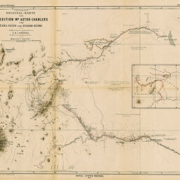
Provisorische Original-Karte der Expedition Wm. Astor Chanler's vom Tana-Fluss zum Guasso-Njiro...
Permalink
https://digital.library.illinois.edu/items/58094130-e946-0133-1d3d-0050569601ca-a
This item is in the public domain.
Descriptive Information
| Title | Provisorische Original-Karte der Expedition Wm. Astor Chanler's vom Tana-Fluss zum Guasso-Njiro... |
| Creator | Höhnel, Ludwig, Ritter von, 1857-1942 |
| Date | 1893 |
| Dimensions | 43.6 x 52.7 cm |
| Place of Publication | Germany |
| Cartographic Scale | 1:500,000 |
| Notes | Includes 1 inset location map (scale 1:2,000,000). |
| Coverage-Spatial | Kenya |
| Subject | |
| Genre | Maps |
| Language | German |
| Color | Printed color |
| Technique | Lithography |
| Source | Petermanns geographische Mitteilungen, V. 39, plate 9. |
| Physical Location | stx |
| Map No. in Bassett and Scheven Bibliography | 1435 |
| Call Number | Q_910_5PE |
| Map ID | afm0001435 |
| Rights | No Copyright - United States |
| Rights Description | This item is in the public domain. |
| Collection Title | Maps of Africa to 1900 |
| Repository | Rare Book & Manuscript Library |
| Type | Cartographic material |
| Collection | Maps of Africa to 1900 |
Download Options
|
Provisorische Original-Karte der Expedition Wm. Astor Chanler's vom Tana-Fluss zum Guasso-Njiro... |
Contact us
for questions and to provide feedback.