
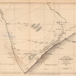
Sketch of the Lower Courses of the Jubb and Haines Rivers, on the N.E. Coast of Africa
Permalink
https://digital.library.illinois.edu/items/58c81790-e946-0133-1d3d-0050569601ca-1
This item is in the public domain.
Descriptive Information
| Title | Sketch of the Lower Courses of the Jubb and Haines Rivers, on the N.E. Coast of Africa |
| Creator | Christopher, W. |
| Date | 1843 |
| Dimensions | 18.6 x 21.4 cm |
| Place of Publication | England |
| Cartographic Scale | 1:2,800,000 |
| Coverage-Spatial | Africa, Eastern |
| Genre | Maps |
| Source | Journal of the Royal Geographic Society, V. 14, after p. 348. |
| Physical Location | rbx |
| Map No. in Bassett and Scheven Bibliography | 1086 |
| Call Number | 910_6ROJ (Online resource, http://www_library_uiuc_edu/orr/results_php?resid=35994) |
| Map ID | afm0001086 |
| Rights | No Copyright - United States |
| Rights Description | This item is in the public domain. |
| Collection Title | Maps of Africa to 1900 |
| Repository | Rare Book & Manuscript Library |
| Type | Cartographic material |
| Collection | Maps of Africa to 1900 |
Download Options
|
Sketch of the Lower Courses of the Jubb and Haines Rivers, on the N.E. Coast of Africa |
Contact us
for questions and to provide feedback.