
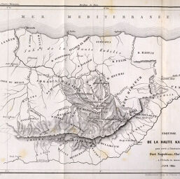
Esquisse de la Haute Kabilie pour servir à l'intinéraire du Fort Napoléon à Chellata
Permalink
https://digital.library.illinois.edu/items/59bbe990-e946-0133-1d3d-0050569601ca-8
This item is in the public domain.
Descriptive Information
| Title | Esquisse de la Haute Kabilie pour servir à l'intinéraire du Fort Napoléon à Chellata |
| Creator | J. Wurster and Co. |
| Date | 1860 |
| Dimensions | 19.5 x 24.8 cm |
| Place of Publication | Switzerland |
| Cartographic Scale | 1:4,000,000 |
| Notes | Relief shown by form lines and spot heights. Paris meridian. |
| Coverage-Spatial | Algeria |
| Subject | |
| Genre | Maps |
| Language | French |
| Color | Bitonal |
| Technique | Lithography |
| Source | Le Globe : bulletin et mémoires de la Société de géographie de Genève, V. 1, between pp. 212-213. |
| Physical Location | stx |
| Map No. in Bassett and Scheven Bibliography | 721 |
| Call Number | 910_5GLO |
| Map ID | afm0000721 |
| Rights | No Copyright - United States |
| Rights Description | This item is in the public domain. |
| Collection Title | Maps of Africa to 1900 |
| Repository | Rare Book & Manuscript Library |
| Type | Cartographic material |
| Collection | Maps of Africa to 1900 |
Download Options
|
Esquisse de la Haute Kabilie pour servir à l'intinéraire du Fort Napoléon à Chellata |
Contact us
for questions and to provide feedback.