
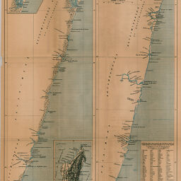
Lacs et Lacunes la Côte Orientale de Madagascar
Permalink
https://digital.library.illinois.edu/items/5af38ca0-e946-0133-1d3d-0050569601ca-2
This item is in the public domain.
Descriptive Information
| Title | Lacs et Lacunes la Côte Orientale de Madagascar |
| Creator | Société de Géographie (France) |
| Date | 1886 |
| Extent | 3 maps on 1 sheet |
| Dimensions | 50.6 x 36.5 cm |
| Place of Publication | France |
| Cartographic Scale | 1:500,000 |
| Notes | Includes inset location map of Madagascar and inset map of the Tamatave (Toamasina) area. |
| Coverage-Spatial | Madagascar |
| Subject | |
| Genre | Maps |
| Language | French |
| Color | Printed color |
| Technique | Lithography |
| Source | Bulletin de la Société de géographie, ser. 7, V. 7, betwee pp. 190-191. |
| Physical Location | stx |
| Map No. in Bassett and Scheven Bibliography | 1298 |
| Call Number | 910_6SOGEASER_7 |
| Map ID | afm0001298 |
| Rights | No Copyright - United States |
| Rights Description | This item is in the public domain. |
| Collection Title | Maps of Africa to 1900 |
| Repository | Rare Book & Manuscript Library |
| Type | Cartographic material |
| Collection | Maps of Africa to 1900 |
Download Options
|
Lacs et Lacunes la Côte Orientale de Madagascar |
Contact us
for questions and to provide feedback.