
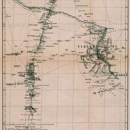
Original-Karte zur Übersicht von Gerhard Rohlfs' Reise durch die grosse Wüste (Sahara) von Mursuk nach Kuka
Permalink
https://digital.library.illinois.edu/items/5b142430-e946-0133-1d3d-0050569601ca-a
This item is in the public domain.
Descriptive Information
| Title | Original-Karte zur Übersicht von Gerhard Rohlfs' Reise durch die grosse Wüste (Sahara) von Mursuk nach Kuka |
| Creator | Petermann, A. (August), 1822-1878 |
| Date | 1868 |
| Dimensions | 43.2 x 24.3 cm |
| Place of Publication | Germany |
| Cartographic Scale | 1:3,500,000 |
| Genre | Maps |
| Color | Hand colored |
| Technique | Lithography |
| Source | Petermanns geographische Mitteilungen, V. 5, No. 25, after p. 75. |
| Physical Location | stx |
| Map No. in Bassett and Scheven Bibliography | 256 |
| Call Number | Q_910_5PE |
| Map ID | afm0000256 |
| Rights | No Copyright - United States |
| Rights Description | This item is in the public domain. |
| Collection Title | Maps of Africa to 1900 |
| Repository | Rare Book & Manuscript Library |
| Type | Cartographic material |
| Collection | Maps of Africa to 1900 |
Download Options
|
Original-Karte zur Übersicht von Gerhard Rohlfs' Reise durch die grosse Wüste (Sahara) von Mursuk nach Kuka |
Contact us
for questions and to provide feedback.