
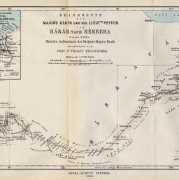
Reiseroute des Major's Heath und des Lieutts. Peyton von Harar nach Bérbera, Juni 1885…
Permalink
https://digital.library.illinois.edu/items/5b3ff1c0-e946-0133-1d3d-0050569601ca-1
This item is in the public domain.
Descriptive Information
| Title | Reiseroute des Major's Heath und des Lieutts. Peyton von Harar nach Bérbera, Juni 1885… |
| Creator | Paulitschke, Philipp, 1854-1899 |
| Date | 1886 |
| Dimensions | 22.1 x 40.6 cm |
| Place of Publication | Germany |
| Cartographic Scale | 1:750,000 |
| Notes | Relief shown by landform drawings and spot heights. Includes 1 inset map (scale 1:4,000,000): Ejssa-Somali un Habr-Aual. |
| Coverage-Spatial | Ethiopia |
| Subject | |
| Genre | Maps |
| Language | German |
| Color | Printed color |
| Technique | Lithography |
| Source | Petermanns geographische Mitteilungen, V. 32, plate 5. |
| Physical Location | stx |
| Map No. in Bassett and Scheven Bibliography | 1291 |
| Call Number | Q_910_5PE |
| Map ID | afm0001291 |
| Rights | No Copyright - United States |
| Rights Description | This item is in the public domain. |
| Collection Title | Maps of Africa to 1900 |
| Repository | Rare Book & Manuscript Library |
| Type | Cartographic material |
| Collection | Maps of Africa to 1900 |
Download Options
|
Reiseroute des Major's Heath und des Lieutts. Peyton von Harar nach Bérbera, Juni 1885… |
Contact us
for questions and to provide feedback.