
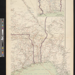
Afrique Occidentale-III-Dahomey
Permalink
https://digital.library.illinois.edu/items/5b49a970-e946-0133-1d3d-0050569601ca-5
This item is in the public domain.
Descriptive Information
| Title | Afrique Occidentale-III-Dahomey |
| Creator | Pelet, Paul, 1849-1927 |
| Date | 1899 |
| Dimensions | 58 x 37 cm |
| Cartographic Scale | 1:3,000,000 |
| Notes | Inset map of Bas-Dahomey (1:1,000,000). |
| Coverage-Spatial | Africa, West |
| Genre | Maps |
| Source | Atlas des Colonies Françaises, Armand Colin & Cie, Carte No. 9. |
| Physical Location | Professor Thomas Bassett Personal Collection |
| Map ID | afm0003254 |
| Rights | No Copyright - United States |
| Rights Description | This item is in the public domain. |
| Collection Title | Maps of Africa to 1900 |
| Repository | Rare Book & Manuscript Library |
| Type | Cartographic material |
| Collection | Maps of Africa to 1900 |
Download Options
|
Afrique Occidentale-III-Dahomey |
Contact us
for questions and to provide feedback.