
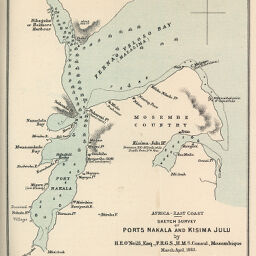
Africa-East Coast: Sketch Survey of Ports Nakala and Kisima Julu by H.E. ONeill
Permalink
https://digital.library.illinois.edu/items/5b6e0410-e946-0133-1d3d-0050569601ca-4
This item is in the public domain.
Descriptive Information
| Title | Africa-East Coast: Sketch Survey of Ports Nakala and Kisima Julu by H.E. ONeill |
| Creator | Royal Geographical Society (Great Britain) |
| Date | 1885 |
| Dimensions | 20.6 x 15.5 cm |
| Place of Publication | England |
| Cartographic Scale | 1:140,000 |
| Coverage-Spatial | Africa, Eastern |
| Genre | Maps |
| Source | Proceedings of the Royal Geographical Society, V. 7, No. 6, after p. 416. |
| Physical Location | rbx |
| Map No. in Bassett and Scheven Bibliography | 1284 |
| Call Number | 910_6RLn_s_ |
| Map ID | afm0001284 |
| Rights | No Copyright - United States |
| Rights Description | This item is in the public domain. |
| Collection Title | Maps of Africa to 1900 |
| Repository | Rare Book & Manuscript Library |
| Type | Cartographic material |
| Collection | Maps of Africa to 1900 |
Download Options
|
Africa-East Coast: Sketch Survey of Ports Nakala and Kisima Julu by H.E. ONeill |
Contact us
for questions and to provide feedback.