
Africa
Permalink
https://digital.library.illinois.edu/items/5c85e890-e946-0133-1d3d-0050569601ca-4
This item is in the public domain.
Descriptive Information
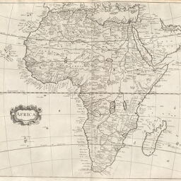
| Title | Africa |
| Creator | Harris, John |
| Date | 1705 |
| Dimensions | 36.2 x 42.5 cm |
| Place of Publication | England |
| Cartographic Scale | 1:21,000,000 |
| Coverage-Spatial | Africa |
| Genre | Maps |
| Source | Navigantium, V. 1, p. 304. |
| Physical Location | rbx |
| Map No. in Bassett and Scheven Bibliography | 55 |
| Call Number | XQ_910_8H24N1705 |
| Map ID | afm0000055 |
| Rights | No Copyright - United States |
| Rights Description | This item is in the public domain. |
| Collection Title | Maps of Africa to 1900 |
| Repository | Rare Book & Manuscript Library |
| Type | Cartographic material |
| Collection | Maps of Africa to 1900 |
Download Options
Contact us
for questions and to provide feedback.