
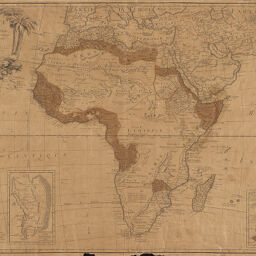
L'Afrique divisée en ses principaux Etats, Assujettie aux Observations Astronomiques.
Permalink
https://digital.library.illinois.edu/items/5caa9740-e946-0133-1d3d-0050569601ca-4
This item is in the public domain.
Descriptive Information
| Title | L'Afrique divisée en ses principaux Etats, Assujettie aux Observations Astronomiques. |
| Creator | Janvier, Jean Denis |
| Date | 1769 |
| Dimensions | 47.5 x 64.6 cm |
| Cartographic Scale | 1:21,000,000 |
| Coverage-Spatial | Africa |
| Genre | Maps |
| Source | Loose sheet |
| Physical Location | rbx |
| Map No. in Bassett and Scheven Bibliography | 100 |
| Call Number | G83001769_J3 |
| Map ID | afm0000100 |
| Rights | No Copyright - United States |
| Rights Description | This item is in the public domain. |
| Collection Title | Maps of Africa to 1900 |
| Repository | Rare Book & Manuscript Library |
| Type | Cartographic material |
| Collection | Maps of Africa to 1900 |
Download Options
|
L'Afrique divisée en ses principaux Etats, Assujettie aux Observations Astronomiques. |
Contact us
for questions and to provide feedback.