
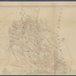
Mission Marchand : le Transnigérien, le Bandama et le Bacoé (la 1ère partie le Bani-Niger a été comprise dans la carte Binger)
Permalink
https://digital.library.illinois.edu/items/5e878d80-85c0-013e-3421-02d0d7bfd6e4-9
This item is in the public domain.
Descriptive Information
| Title | Mission Marchand : le Transnigérien, le Bandama et le Bacoé (la 1ère partie le Bani-Niger a été comprise dans la carte Binger) |
| Alternative Title | Mission Marchand : le Transnigérien, le Bandama et le Bacoé (la 1ère partie le Bani-Niger a été comprise dans la carte Binger) / Service géographique des colonies ; carte levée et dressée de 1892 à 1895 par le capitaine Marchand |
| Creator | France. Service géographique des colonies |
| Contributor | Marchand, Jean-Baptiste,1863-1934 |
| Date | 1895 |
| Extent | 1 map : color |
| Dimensions | 147 x 93 cm |
| Place of Publication | Paris (France) |
| Publisher | Maison Andriveau-Goujon (Firm) |
| Cartographic Scale | Scale [ca. 1:500,000] |
| Cartographic Coordinates | W 10°00'--W 5°40'/N 11°00'--N 4°20' |
| Notes |
|
| Coverage-Spatial | Africa, West |
| Genre | Maps |
| Language | French |
| Call Number | G8736.S12 1895 .S4 |
| Rights | No Copyright - United States |
| Rights Description | This item is in the public domain. |
| Collection Title | Maps of Africa to 1900 |
| Repository | Rare Book & Manuscript Library |
| Type | Cartographic material |
| Bibliographic Identifier | 99698132012205899 |
| Collection | Maps of Africa to 1900 |
Download Options
|
99698132012205899-00000001 | |

|
99698132012205899-00000002 |
Contact us
for questions and to provide feedback.