
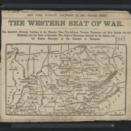
The western seat of war : the important strategic positions of the western war, the advance towards Tennessee and New Orleans via the Mississippi and the state of Kentucky, the points of resisitance selected by the Rebels, and the bridges destroyed by the Unionists in Tennessee
Permalink
https://digital.library.illinois.edu/items/662ecb10-ba7a-013d-5129-02d0d7bfd6e4-e
This item is in the public domain.
Descriptive Information
| Title | The western seat of war : the important strategic positions of the western war, the advance towards Tennessee and New Orleans via the Mississippi and the state of Kentucky, the points of resisitance selected by the Rebels, and the bridges destroyed by the Unionists in Tennessee |
| Creator | New York Herald Company |
| Scale | Scale approximately 1:3,800,000 |
| Place of Publication | New York (N.Y.) |
| Publisher | New York herald |
| Date of Publication | 1861-12-10 |
| Extent | 1 map |
| Dimensions | 13 x 22 cm |
| Notes |
|
| Coverage-Spatial | |
| Language | English |
| Subject | |
| Genre | Maps |
| Rights | No Copyright - United States |
| Rights Description | This item is in the public domain. |
| Type | Cartographic material |
| Repository | Map Library |
| Local Bib ID | 99955571920805899 |
| Collection Title | Civil War Maps |
| Collection | Civil War Maps |
Download Options
|
The western seat of war : the important strategic positions of the western war, the advance towards Tennessee and New Orleans via the Mississippi and the state of Kentucky, the points of resisitance selected by the Rebels, and the bridges destroyed by the Unionists in Tennessee |
Contact us
for questions and to provide feedback.