
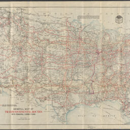
General map of transcontinental routes with principal connections / American Automobile Association
Panel title: Transcontinental road map official
Permalink
https://digital.library.illinois.edu/items/6f8ecf60-1f6a-013c-489c-02d0d7bfd6e4-0
No Copyright - United States
Descriptive Information
| Title | General map of transcontinental routes with principal connections / American Automobile Association |
| Alternative Title | Panel title: Transcontinental road map official |
| Creator | American Automobile Association |
| Scale | Scale approximately 1:4,500,000 |
| Place of Publication |
|
| Publisher | American Automobile Association |
| Date of Publication | 1926 |
| Extent | 1 map : color |
| Dimensions | 66 x 99 cm, folded to 24 x 11 cm |
| Notes |
|
| Coverage-Spatial | United States |
| Language | English |
| Subject | Roads |
| Associated Entities | Chicago Motor Club |
| Genre | |
| Rights | No Copyright - United States |
| Type | Cartographic material |
| Repository | Map Library |
| Local Bib ID | 99162167812205899 |
| Collection Title | 1920s Maps |
| Collection | 1920s Maps |
Download Options
|
General map of transcontinental routes with principal connections / American Automobile Association |
Contact us
for questions and to provide feedback.