
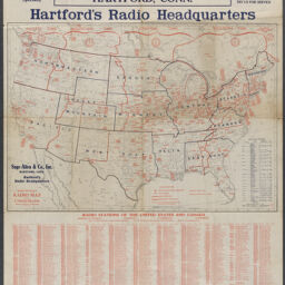
Radio map of the United States
Permalink
https://digital.library.illinois.edu/items/6feafde0-1f6a-013c-489c-02d0d7bfd6e4-b
No Copyright - United States
Descriptive Information
| Title | Radio map of the United States |
| Alternative Title | Alternate title in lower left: Rand McNally radio map of the United States |
| Creator | Rand McNally and Company |
| Scale | Scale approximately 1:6,969,600. Statute miles, 110 = 1 in. |
| Coordinates | (W 127°--W 65°/N 54°--N 24°) |
| Place of Publication | Chicago (Ill.) |
| Publisher | Rand McNally and Company |
| Date of Publication | 1924-1925 |
| Extent | 1 map : color |
| Dimensions | 47 x 68 cm |
| Notes |
|
| Coverage-Spatial | United States |
| Language | English |
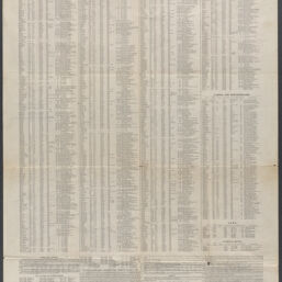
| Subject | Radio stations. |
| Genre | |
| Rights | No Copyright - United States |
| Type | Cartographic material |
| Repository | Map Library |
| Local Bib ID | 99907973712205899 |
| Collection Title | 1920s Maps |
| Collection | 1920s Maps |
Download Options
|
99907973712205899-001 | |
|
99907973712205899-002 |
Contact us
for questions and to provide feedback.