
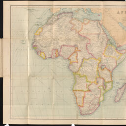
Africa
Permalink
https://digital.library.illinois.edu/items/729a6ac0-3dcb-013b-c8a3-02d0d7bfd6e4-1
This item is in the public domain.
Descriptive Information
| Title | Africa |
| Creator | George Philip & Son |
| Date | 1890 |
| Dimensions | 51 x 60 cm |
| Publisher | The London Geograhical Institute |
| Cartographic Scale | 1:17,500,000 |
| Notes | Circa 1890. |
| Coverage-Spatial | Africa |
| Genre | Maps |
| Language | English |
| Physical Location | Professor Thomas Bassett Personal Collection |
| Map ID | afm0003454 |
| Rights | No Copyright - United States |
| Rights Description | This item is in the public domain. |
| Collection Title | Maps of Africa to 1900 |
| Repository | Rare Book & Manuscript Library |
| Type | Cartographic material |
| Collection | Maps of Africa to 1900 |
Download Options
Contact us
for questions and to provide feedback.