
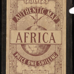
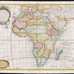
Carte d'Afrique Dresés pour l'Usage du Roi…Révue et Augmentée par Dezauche
Permalink
https://digital.library.illinois.edu/items/729e6dd0-3dcb-013b-c8a3-02d0d7bfd6e4-2
This item is in the public domain.
Descriptive Information
| Title | Carte d'Afrique Dresés pour l'Usage du Roi…Révue et Augmentée par Dezauche |
| Creator | L'Isle, Guillaume de, 1675-1726 |
| Date | 1787 |
| Dimensions | 48 x 62.3 cm |
| Place of Publication | Paris (France) |
| Publisher | Dezauche, Jean-Claude, 1754?-1824 |
| Cartographic Scale | 1:17,000,000 |
| Coverage-Spatial | Africa |
| Genre | Maps |
| Language | French |
| Physical Location | Professor Thomas Bassett Personal Collection |
| Map ID | afm0003455 |
| Rights | No Copyright - United States |
| Rights Description | This item is in the public domain. |
| Collection Title | Maps of Africa to 1900 |
| Repository | Rare Book & Manuscript Library |
| Type | Cartographic material |
| Collection | Maps of Africa to 1900 |
Download Options
|
afm0003455-001 | |
|
afm0003455-002 | |
|
afm0003455-003 |
Contact us
for questions and to provide feedback.