
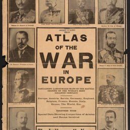
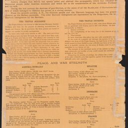
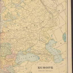
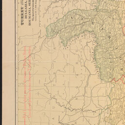
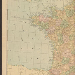
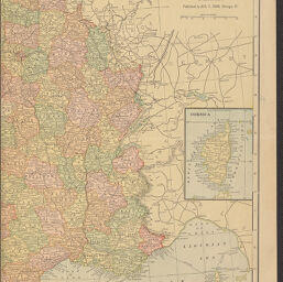
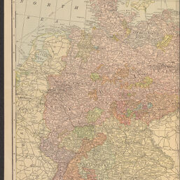
Atlas of the war in Europe containing large-scale maps of the battleground of the world's most gigantic conflict : Europe, Austria, Servia, Germany, England, Belgium, France, Russia, Italy, Greece, The World, etc., together with special data showing comparison of armies and navies involved
Permalink
https://digital.library.illinois.edu/items/72adaf80-b099-0136-5269-0050569601ca-7
No Copyright - United States
Descriptive Information
| Title | Atlas of the war in Europe containing large-scale maps of the battleground of the world's most gigantic conflict : Europe, Austria, Servia, Germany, England, Belgium, France, Russia, Italy, Greece, The World, etc., together with special data showing comparison of armies and navies involved |
| Place of Publication | Chicago (Ill.) |
| Publisher | Cram, George Franklin, 1841-1928 |
| Date of Publication | 1914 |
| Extent | [16] pages, color maps |
| Dimensions | 38 cm |
| Notes | Published circa 1914. |
| Coverage-Spatial | Europe |
| Language | English |
| Subject | World War, 1914-1918 |
| Genre | Maps |
| Rights Description | No Copyright - United States |
| Type | Cartographic material |
| Repository | Map Library |
| Local Bib ID | 2949627 |
| Collection Title | World War I Maps |
| Collection | World War I Maps |
Download Options
|
2949627-001 | |
|
2949627-002 | |

|
2949627-003 | |

|
2949627-004 | |
|
2949627-005 | |

|
2949627-006 | |

|
2949627-007 | |

|
2949627-008 | |

|
2949627-009 | |
|
2949627-010 | |

|
2949627-011 | |
|
2949627-012 | |
|
2949627-013 | |
|
2949627-014 | |

|
2949627-015 | |

|
2949627-016 | |

|
2949627-017 | |

|
2949627-018 | |

|
2949627-019 | |

|
2949627-020 |
Contact us
for questions and to provide feedback.