
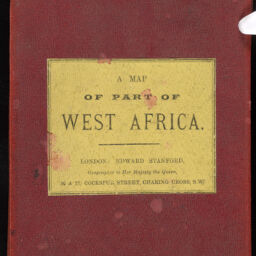
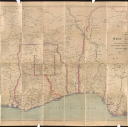
A Map of Part of West Africa including the Gold Coast, Lagos, the Niger Coast Protectorate, and part of the Royal Niger Company's Territory
Permalink
https://digital.library.illinois.edu/items/7392ba60-3dcb-013b-c8a3-02d0d7bfd6e4-1
This item is in the public domain.
Descriptive Information
| Title | A Map of Part of West Africa including the Gold Coast, Lagos, the Niger Coast Protectorate, and part of the Royal Niger Company's Territory |
| Creator | Edward Stanford Ltd. |
| Date | 1898 |
| Dimensions | 63 x 88 cm |
| Place of Publication | London (England) |
| Publisher | Edward Stanford Ltd. |
| Cartographic Scale | 1: 1,900,800 |
| Coverage-Spatial | Africa, West |
| Genre | Maps |
| Language | English |
| Physical Location | Professor Thomas Bassett Personal Collection |
| Map ID | afm0003506 |
| Rights | No Copyright - United States |
| Rights Description | This item is in the public domain. |
| Collection Title | Maps of Africa to 1900 |
| Repository | Rare Book & Manuscript Library |
| Type | Cartographic material |
| Collection | Maps of Africa to 1900 |
Download Options
|
afm0003506-001 | |
|
afm0003506-002 | |
|
afm0003506-003 |
Contact us
for questions and to provide feedback.