
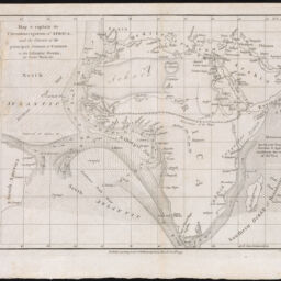
Map to explain the Circumnavigation of Africa, and the Courses of the Principal Streams of Current, in the Atlantic Ocean, the Trade Winds
Permalink
https://digital.library.illinois.edu/items/73a03a60-3dcb-013b-c8a3-02d0d7bfd6e4-c
This item is in the public domain.
Descriptive Information
| Title | Map to explain the Circumnavigation of Africa, and the Courses of the Principal Streams of Current, in the Atlantic Ocean, the Trade Winds |
| Creator | Rennell, James, 1742-1830 |
| Date | 1799 |
| Dimensions | 23 x 29.3 cm |
| Place of Publication | London (England) |
| Publisher | Bulmer, W. |
| Cartographic Scale | 1:41,000,000 |
| Notes | In James Rennell, The Geographical System of Herodutus. W. Bulmer, 1800. |
| Coverage-Spatial | Africa |
| Genre | Maps |
| Language | English |
| Physical Location | Professor Thomas Bassett Personal Collection |
| Map ID | afm0003509 |
| Rights | No Copyright - United States |
| Rights Description | This item is in the public domain. |
| Collection Title | Maps of Africa to 1900 |
| Repository | Rare Book & Manuscript Library |
| Type | Cartographic material |
| Collection | Maps of Africa to 1900 |
Download Options
|
Map to explain the Circumnavigation of Africa, and the Courses of the Principal Streams of Current, in the Atlantic Ocean, the Trade Winds |
Contact us
for questions and to provide feedback.