
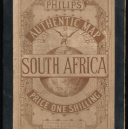
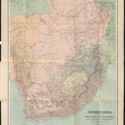
Southern Africa Including The Cape Colony, Natal, South African Republic, Orange Free State, Bechuanaland, Matabeleland &c
Permalink
https://digital.library.illinois.edu/items/73b1a3a0-3dcb-013b-c8a3-02d0d7bfd6e4-d
This item is in the public domain.
Descriptive Information
| Title | Southern Africa Including The Cape Colony, Natal, South African Republic, Orange Free State, Bechuanaland, Matabeleland &c |
| Creator | George Philip & Son |
| Date | 1893 |
| Dimensions | 60 x 50.5 cm |
| Place of Publication | Liverpool (England) |
| Cartographic Scale | 1:3,900,000 |
| Coverage-Spatial | Africa, Southern |
| Genre | Maps |
| Language | English |
| Physical Location | Professor Thomas Bassett Personal Collection |
| Map ID | afm0003512 |
| Rights | No Copyright - United States |
| Rights Description | This item is in the public domain. |
| Collection Title | Maps of Africa to 1900 |
| Repository | Rare Book & Manuscript Library |
| Type | Cartographic material |
| Collection | Maps of Africa to 1900 |
Download Options
|
afm0003512-001 | |
|
afm0003512-002 | |
|
afm0003512-003 |
Contact us
for questions and to provide feedback.