
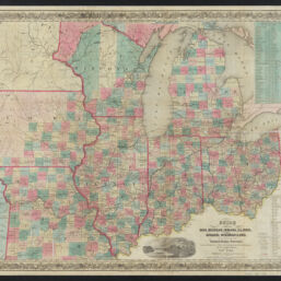
Guide through Ohio, Michigan, Indiana, Illinois, Missouri, Wisconsin & Iowa : showing the township lines of the United States surveys, location of cities, towns, villages, post hamlets, canals, rail and stage roads
Permalink
https://digital.library.illinois.edu/items/776d7600-cd50-013d-2ea7-02d0d7bfd6e4-f
This item is in the public domain.
Descriptive Information
| Title | Guide through Ohio, Michigan, Indiana, Illinois, Missouri, Wisconsin & Iowa : showing the township lines of the United States surveys, location of cities, towns, villages, post hamlets, canals, rail and stage roads |
| Creator | |
| Date | 1848 |
| Decade | 1840s |
| Description | by J. Calvin Smith ; engraved by S. Stiles, Sherman & Smith |
| Cartographic Scale | Scale approximately 1:2,100,000 (W 96°30ʹ--W 80°25ʹ/N 46°10ʹ--N 36°45ʹ) |
| Extent | 1 map |
| Dimensions | 46 x 58 cm |
| Language | English |
| Publisher | J.H. Colton |
| Place of Publication | New York |
| Collection Title | Historic Maps of Illinois and the Midwest |
| Rights | No Copyright - United States |
| Rights Description | This item is in the public domain. |
| Repository | Illinois History and Lincoln Collections |
| Type | Cartographic material |
| Identifier | 99855015612205899 |
| Bibliographic Identifier | 99855015612205899 |
| Local barcode | 30112113180894 |
| Collection | Historic Maps of Illinois and the Midwest |
Download Options
|
99855015612205899-00000001 | |

|
99855015612205899-00000002 |
Contact us
for questions and to provide feedback.