
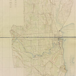
Topographic map of the Plattsburg Training Camp, New York
Plattsburg Training Camp, New York
Permalink
https://digital.library.illinois.edu/items/7b00c170-1eea-0137-6b87-02d0d7bfd6e4-1
No Copyright - United States
Descriptive Information
| Title | Topographic map of the Plattsburg Training Camp, New York |
| Alternative Title | Plattsburg Training Camp, New York |
| Creator | Geological Survey (U.S.) |
| Contributor | |
| Scale | Scale 1:21,120. 3 in. to 1 mile |
| Coordinates | (W 73°35ʹ--W 73°25ʹ/N 44°50ʹ--N 44°34ʹ) |
| Place of Publication | Washington (D.C.) |
| Publisher | Geological Survey (U.S.) |
| Date of Publication | 1917 |
| Extent | 1 map on 2 sheets, color |
| Dimensions | 141 x 63 cm, on sheet 162 x 79 cm |
| Notes |
|
| Coverage-Spatial | Plattsburgh Barracks (N.Y.) |
| Language | English |
| Genre | Topographic maps |
| Rights Description | No Copyright - United States |
| Type | Cartographic material |
| Repository | Map Library |
| Local Bib ID | 1621013 |
| Collection Title | World War I Maps |
| Collection | World War I Maps |
Download Options
|
Topographic map of the Plattsburg Training Camp, New York |
Contact us
for questions and to provide feedback.