
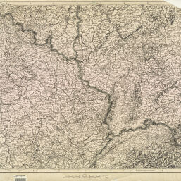
Map showing Franco-German frontier
Permalink
https://digital.library.illinois.edu/items/7b158540-1eea-0137-6b87-02d0d7bfd6e4-5
No Copyright - United States
Descriptive Information
| Title | Map showing Franco-German frontier |
| Creator | United States. War Department. General Staff. War College Division |
| Scale | Scale approximately 1:800,000 |
| Coordinates | (E 2°--E 11°/N 52°--N 46°) |
| Place of Publication | Washington (D.C.) |
| Publisher | United States. War Department. General Staff. War College Division |
| Date of Publication | 1914 |
| Extent | 1 map |
| Dimensions | 63 x 76 cm |
| Coverage-Spatial | |
| Language | English |
| Genre | Thematic maps |
| Source |
|
| Rights Description | No Copyright - United States |
| Type | Cartographic material |
| Repository | Map Library |
| Local Bib ID | 3999029 |
| Collection Title | World War I Maps |
| Collection | World War I Maps |
Download Options
|
3999029_001 | |

|
3999029_002 |
Contact us
for questions and to provide feedback.