
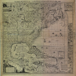
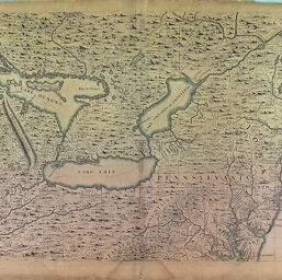
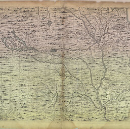
(Four sheets) A map of the British Empire in America with the French and Spanish settlements adjacent thereto
Permalink
https://digital.library.illinois.edu/items/9138a110-82d4-0134-1f08-0050569601ca-7Descriptive Information
| Title | (Four sheets) A map of the British Empire in America with the French and Spanish settlements adjacent thereto |
| Author | Popple, Henry, d. 1743 |
| Coverage-Spatial | North America |
| Subject | Early works to 1800 |
| Type | Cartographic material |
| Genre | Maps |
| Description |
|
| Extent |
|
| Dimensions | 53 cm |
| Date | 1733 |
| Contributors | Toms, W. H. (William Henry), ca. 1700-ca. 1750 |
| Scale | Scale ca. 1:10,000,000 |
| Repository | Map Library |
| Collection Publisher | University of Illinois at Urbana-Champaign. Map Library |
| Call Number | G3300 1733 .P8 |
| Language | English |
| Collection Title | Historical Maps Online |
| Collection | Historical Maps Online |
Download Options
|
9372617732002_G3300_1733_P8_key.tif | |

|
A map of the British Empire in America with the French and Spanish settlements adjacent thereto | |
|
A map of the British Empire in America with the French and Spanish settlements adjacent thereto | |
|
A map of the British Empire in America with the French and Spanish settlements adjacent thereto | |

|
A map of the British Empire in America with the French and Spanish settlements adjacent thereto |
Contact us
for questions and to provide feedback.