
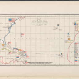
Map of the North Atlantic Ocean : showing European colonial possessions under their national flags, 1898 ; Map of the China Seas showing Philippine Islands and adjacent countries : with European colonial possessions under their national flags, 1898
Permalink
https://digital.library.illinois.edu/items/92d18140-50c1-013e-321b-02d0d7bfd6e4-d
This item is in the public domain.
Descriptive Information
| Title | Map of the North Atlantic Ocean : showing European colonial possessions under their national flags, 1898 ; Map of the China Seas showing Philippine Islands and adjacent countries : with European colonial possessions under their national flags, 1898 |
| Alternative Title | Map of the China Seas showing Philippine Islands and adjacent countries |
| Creator | Duncan, W. B. |
| Contributor | Harper & Brothers |
| Scale | Scale approximately 1:30,000,000 |
| Coordinates |
|
| Place of Publication | New York (N.Y.) |
| Publisher | Harper's weekly |
| Date of Publication | 1898-06-11 |
| Extent | 2 maps : color |
| Dimensions | 18 x 33 cm and 19 x 21 cm |
| Notes |
|
| Coverage-Spatial | |
| Language | English |
| Genre | |
| Rights | No Copyright - United States |
| Rights Description | This item is in the public domain. |
| Type | Cartographic material |
| Repository | Map Library |
| Local Bib ID | 99955652816805899 |
| Collection Title | American Empire Maps |
| Collection | American Empire Maps |
Download Options

|
99955652816805899-00000001 | |
|
99955652816805899-00000002 |
Contact us
for questions and to provide feedback.