|
|
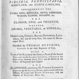
A topographical description of Virginia, Pennsylvania, Maryland, and North Carolina : comprehending the rivers Ohio, Kenhawa, Sioto, Cherokee, Wabash, Illinois, Mississippi, &c. the climate, soil and produce, whether animal, vegetable, or mineral ; the mountains, creeks, roads, distances, latitudes, &c. and of every part laid down in the annexed map / published by Thomas Hutchins, captain in the 60th regiment of foot ; with a plan of the rapids of the Ohio, a plan of the several villages in the Illinois country, a table of the distances between Fort Pitt and the mouth of the Ohio, all engraved upon copper ; and an appendix, containing Mr. Patrick Kennedy's Journal up the Illinois River, and a correct list of the different nations and tribes of Indians, with the number of fighting men, &c.
|
|
|
|
A plan of the several villages in the Illinois Country, with part of the River Mississippi & c.
|
|
|
|
A topographical description of Virginia, Pennsylvania, Maryland, and North Carolina : comprehending the rivers Ohio, Kenhawa, Sioto, Cherokee, Wabash, Illinois, Mississippi, &c. the climate, soil and produce, whether animal, vegetable, or mineral ; the mountains, creeks, roads, distances, latitudes, &c. and of every part laid down in the annexed map / published by Thomas Hutchins, captain in the 60th regiment of foot ; with a plan of the rapids of the Ohio, a plan of the several villages in the Illinois country, a table of the distances between Fort Pitt and the mouth of the Ohio, all engraved upon copper ; and an appendix, containing Mr. Patrick Kennedy's Journal up the Illinois River, and a correct list of the different nations and tribes of Indians, with the number of fighting men, &c.
|
|
|
|
A topographical description of Virginia, Pennsylvania, Maryland, and North Carolina : comprehending the rivers Ohio, Kenhawa, Sioto, Cherokee, Wabash, Illinois, Mississippi, &c. the climate, soil and produce, whether animal, vegetable, or mineral ; the mountains, creeks, roads, distances, latitudes, &c. and of every part laid down in the annexed map / published by Thomas Hutchins, captain in the 60th regiment of foot ; with a plan of the rapids of the Ohio, a plan of the several villages in the Illinois country, a table of the distances between Fort Pitt and the mouth of the Ohio, all engraved upon copper ; and an appendix, containing Mr. Patrick Kennedy's Journal up the Illinois River, and a correct list of the different nations and tribes of Indians, with the number of fighting men, &c.
|
|