The items in the Digital Collections of the University of Illinois Urbana-Champaign Library contain materials which represent or depict sensitive topics or were written from perspectives using outdated or biased language. The Library condemns discrimination and hatred on any grounds. As a research library that supports the mission and values of this land grant institution, it is incumbent upon the University Library to preserve, describe, and provide access to materials to accurately document our past, support learning about it, and effect change in the present. In accordance with the American Library Association’s Freedom to Read statement, we do not censor our materials or prevent patrons from accessing them.
While there is an indication of contour interval, none of the "contour" lines on the map have explictly defined values.
"Topography from Canadian Boundary Commission photo-topographic surveys, 1893-1895. Reduced from 1:80,000 sheets, having contours 250 ft. intervals."
<http://rightsstatements.org/vocab/NoC-US/1.0/> Cartographic material Map Library 99399707112205899 American Empire Maps 9a9c74d0-9dc3-013c-4aba-02d0d7bfd6e4-2 2057/6022/99399714112205899/preservation/99399714112205899-001 99399714112205899-001 a8241e40-9dc3-013c-4aba-02d0d7bfd6e4-7 2057/6022/99399714112205899/access/99399714112205899-001.jp2 99399714112205899-001.jp2 a7e39330-9dc3-013c-4aba-02d0d7bfd6e4-0 true 22 Southeastern Alaska and part of British Columbia : shewing award of Alaska Tribunal, Oct. 20th, 1903 Scale 1:960,000 Ottawa (Canada) Mortimer Co. Limited 1903 1 map : color 92 x 49 cm The points designated hereon by the letters are those referred to in the Award of the Tribunal. The red dotted lines connecting the points marked S are not on the original map.
Relief shown by contours and spot heights. Alaska Military reconnaissance United States.War Department
Contour interval approx. 500 feet.
Shows area north of Prince WIlliam Sound, indicating exploration routes along Copper, Matanuska, Sushitna, and Tanana rivers skirting the Talkeetno and Chugatch mountains, northward to the Yukon River.
Mahlo, Emil. (1898). 
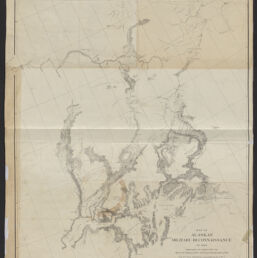
Map of Alaskan military reconnaissance of 1898. American Empire Maps, Map Library, University of Illinois at Urbana-Champaign Library. https://digital.library.illinois.edu/items/9a92c4d0-9dc3-013c-4aba-02d0d7bfd6e4-2