
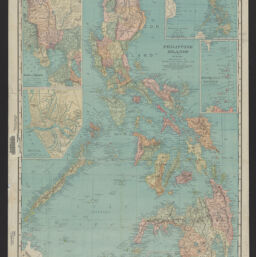
Philippine Islands
Permalink
https://digital.library.illinois.edu/items/9af43b20-9dc3-013c-4aba-02d0d7bfd6e4-d
No Copyright - United States
Descriptive Information
| Title | Philippine Islands |
| Creator | Rand McNally and Company |
| Scale | Scale 1:2,280,960. Statute miles, 36 = 1 in. Kilometres, 56 = 1 in. |
| Coordinates | (E 116°50ʹ--E 126°30ʹ/N 18°40ʹ--N 5°20ʹ) |
| Place of Publication | Chicago (Ill.) |
| Publisher | Rand McNally & Co. |
| Date of Publication | 1904 |
| Extent | 1 map : color |
| Dimensions | 65 x 47 cm |
| Notes |
|
| Coverage-Spatial | Philippines |
| Genre | Maps |
| Rights | No Copyright - United States |
| Type | Cartographic material |
| Repository | Map Library |
| Local Bib ID | 99809609112205899 |
| Collection Title | American Empire Maps |
| Collection | American Empire Maps |
Download Options
|
99809609112205899-001 | |

|
99809609112205899-002 |
Contact us
for questions and to provide feedback.