
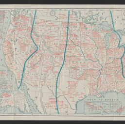
Industrial map of the United States and new possessions
Permalink
https://digital.library.illinois.edu/items/9b09b100-9dc3-013c-4aba-02d0d7bfd6e4-e
No Copyright - United States
Descriptive Information
| Title | Industrial map of the United States and new possessions |
| Alternative Title | 20th century industrial map of the United States |
| Creator | Waite, John F. |
| Scale | Scale approximately 1:9,325,000 |
| Coordinates | (W 125°--W 65°/N 52°--N 25°) |
| Place of Publication | Chicago (Ill.) |
| Publisher | Fort Dearborn Pub. Co. |
| Date of Publication | 1901 |
| Extent | 1 map : color |
| Dimensions | 32 x 50 cm, folded in cover 14 x 9 cm |
| Notes |
|
| Coverage-Spatial | United States |
| Subject | |
| Associated Entities | Fort Dearborn Publishing Co. |
| Genre | Maps |
| Rights | No Copyright - United States |
| Type | Cartographic material |
| Repository | Map Library |
| Local Bib ID | 99954869479105899 |
| Collection Title | American Empire Maps |
| Collection | American Empire Maps |
Download Options
|
99954869479105899-001 | |

|
99954869479105899-002 |
Contact us
for questions and to provide feedback.