
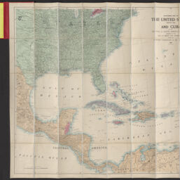
Stanford's map of the United States (eastern part) and Cuba with the Central & South American republics bordering on the Gulf of Mexico and Caribbean Sea shewing the European dependencies in the West Indies & c.
Permalink
https://digital.library.illinois.edu/items/9b267b70-9dc3-013c-4aba-02d0d7bfd6e4-b
No Copyright - United States
Descriptive Information
| Title | Stanford's map of the United States (eastern part) and Cuba with the Central & South American republics bordering on the Gulf of Mexico and Caribbean Sea shewing the European dependencies in the West Indies & c. |
| Alternative Title | Stanford's map of the United States (eastern part) and Cuba with the Central and South American republics bordering on the Gulf of Mexico and Caribbean Sea showing the European dependencies in the West Indies & c. |
| Creator | Edward Stanford Ltd. |
| Scale | Scale approximately 1:5,300,000 |
| Coordinates | (W 105°--W 55°/N 42°--N 5°) |
| Place of Publication | London (England) |
| Publisher | Edward Stanford Ltd. |
| Date of Publication | 1898 |
| Extent | 1 map : color |
| Dimensions | 77 x 87 cm, folded in cover 18 x 13 cm |
| Notes |
|
| Coverage-Spatial | |
| Genre | Maps |
| Rights | No Copyright - United States |
| Type | Cartographic material |
| Repository | Map Library |
| Local Bib ID | 99955393027105899 |
| Collection Title | American Empire Maps |
| Collection | American Empire Maps |
Download Options
|
99955393027105899-001 | |

|
99955393027105899-002 | |

|
99955393027105899-003 |
Contact us
for questions and to provide feedback.