
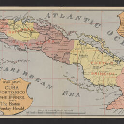
War maps of Cuba, Porto Rico, and the Philippines
War maps of Cuba, Puerto Rico, and the Philippines
Permalink
https://digital.library.illinois.edu/items/9b5270e0-9dc3-013c-4aba-02d0d7bfd6e4-0
No Copyright - United States
Descriptive Information
| Title | War maps of Cuba, Porto Rico, and the Philippines |
| Alternative Title | War maps of Cuba, Puerto Rico, and the Philippines |
| Creator | Boston Herald |
| Scale | |
| Coordinates |
|
| Place of Publication | Boston (Mass.) |
| Publisher | Boston Sunday Herald |
| Date of Publication | 1898 |
| Extent | 3 maps on 1 sheet : color |
| Dimensions | 24 x 64 cm or smaller, on sheet 24 x 73 cm |
| Notes |
|
| Coverage-Spatial | |
| Subject | Spanish-American War, 1898 |
| Genre | Maps |
| Rights | No Copyright - United States |
| Type | Cartographic material |
| Repository | Map Library |
| Local Bib ID | 99955478825605899 |
| Collection Title | American Empire Maps |
| Collection | American Empire Maps |
Download Options
|
War maps of Cuba, Porto Rico, and the Philippines |
Contact us
for questions and to provide feedback.