
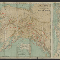
Map of Alaska and portions of the Northwest Territory, showing routes to the gold fields
Permalink
https://digital.library.illinois.edu/items/9b7033c0-9dc3-013c-4aba-02d0d7bfd6e4-2
No Copyright - United States
Descriptive Information
| Title | Map of Alaska and portions of the Northwest Territory, showing routes to the gold fields |
| Alternative Title | Alaska and the gold fields of the Yukon, the Klondike Cook Inlet and other mining regions |
| Creator | Poole Brothers |
| Scale | Scale approximately 1:4,450,000 |
| Coordinates | (W 180°--W 118°/N 072°--N 053°) |
| Place of Publication | Chicago (Ill.) |
| Publisher | |
| Date of Publication | 1897 |
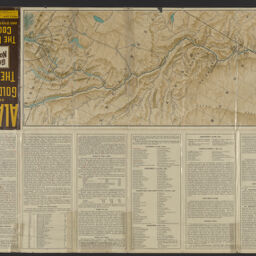
| Extent | 1 map : color |
| Dimensions | 44 x 57 cm, folded to 24 x 11 cm |
| Notes |
|
| Coverage-Spatial | |
| Subject | Gold mines and mining |
| Associated Entities | |
| Genre | Maps |
| Rights | No Copyright - United States |
| Type | Cartographic material |
| Repository | Map Library |
| Local Bib ID | 99955483980605899 |
| Collection Title | American Empire Maps |
| Collection | American Empire Maps |
Download Options
|
99955483980605899-001 | |
|
99955483980605899-002 |
Contact us
for questions and to provide feedback.