
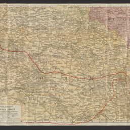
War map of the French front, northern section : a strategic map of the battle ground in France from St. Quentin to St. Mihiel, showing the farthest advance of the Germans in 1914 and the battle line in 1918 : compiled from the latest military maps of the army staffs in Washington, London, and Paris, and from other official sources, presented in minute detail with cities, towns and villages, forts and fortified places, railroads and highways, rivers and canals, the forests, and the physical and political features of the regions
Permalink
https://digital.library.illinois.edu/items/a11cdc80-88dd-013a-c212-02d0d7bfd6e4-7
No Copyright - United States
Descriptive Information
| Title | War map of the French front, northern section : a strategic map of the battle ground in France from St. Quentin to St. Mihiel, showing the farthest advance of the Germans in 1914 and the battle line in 1918 : compiled from the latest military maps of the army staffs in Washington, London, and Paris, and from other official sources, presented in minute detail with cities, towns and villages, forts and fortified places, railroads and highways, rivers and canals, the forests, and the physical and political features of the regions |
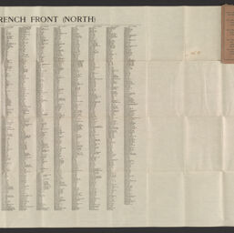
| Alternative Title | Title at head of legend: Rand McNally war map of the French front, northern section : strategic map of the battle ground in northern France from St. Quentin to St. Mihiel : compiled from the latest military maps of the army staffs in Washington, London, and Paris, and from other official sources |
| Creator | United States. Council of National Defense. Women's Committee. Illinois Division |
| Scale | Scale 1:253,440. 1 inch = 4 miles |
| Place of Publication |
|
| Publisher | Rand McNally and Company |
| Date of Publication | 1918 |
| Extent | 1 map : color |
| Dimensions | 56 x 81 cm, folded in cover 16 x 10 cm |
| Notes |
|
| Coverage-Spatial | |
| Language | English |
| Subject | |
| Genre | Maps |
| Rights Description | No Copyright - United States |
| Type | Cartographic material |
| Repository | Map Library |
| Local Bib ID | 99955030078505899 |
| Collection Title | World War I Maps |
| Collection | World War I Maps |
Download Options
|
99955030078505899-001 | |
|
99955030078505899-002 |
Contact us
for questions and to provide feedback.