
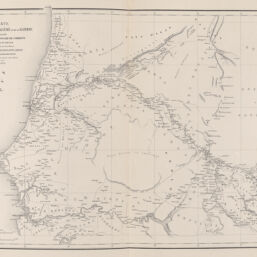
Carte du Sénégal, de la Falémé et de la Gambie
Permalink
https://digital.library.illinois.edu/items/c621bbb0-0485-013c-47d9-02d0d7bfd6e4-8
This item is in the public domain.
Descriptive Information
| Title | Carte du Sénégal, de la Falémé et de la Gambie |
| Creator | Brossard de Corbigny, Charles-Paul |
| Contributor | |
| Date | 1862 |
| Dimensions | 28.5 x 40 cm |
| Place of Publication | Paris (France) |
| Publisher | Challamel ainé |
| Cartographic Scale | 1:2,045,700 |
| Coverage-Spatial | Africa, West |
| Language | French |
| Physical Location | Professor Thomas Bassett Personal Collection |
| Map ID | AFM0003543 |
| Rights | No Copyright - United States |
| Rights Description | This item is in the public domain. |
| Collection Title | Maps of Africa to 1900 |
| Repository | Rare Book & Manuscript Library |
| Type | Cartographic material |
| Collection | Maps of Africa to 1900 |
Download Options
|
Carte du Sénégal, de la Falémé et de la Gambie |
Contact us
for questions and to provide feedback.