
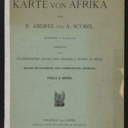
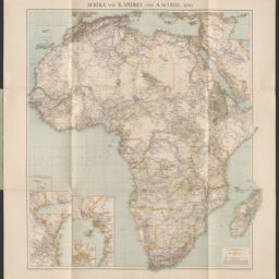
Afrika von R. Andree und A. Scobel. 1890.
Permalink
https://digital.library.illinois.edu/items/c6f86fa0-0485-013c-47d9-02d0d7bfd6e4-a
This item is in the public domain.
Descriptive Information
| Title | Afrika von R. Andree und A. Scobel. 1890. |
| Creator | |
| Date | 1890 |
| Dimensions | 84 x 74 cm |
| Place of Publication |
|
| Publisher | Verlag von Velhagen & Klasing |
| Cartographic Scale | 1:20,000,000 |
| Notes | Inets of Cape Verde Isles; Slave Coast; Zanzibar and German East Africa; and Cameroon. |
| Coverage-Spatial | Africa |
| Language | German |
| Physical Location | Professor Thomas Bassett Personal Collection |
| Map ID | AFM0003583 |
| Rights | No Copyright - United States |
| Rights Description | This item is in the public domain. |
| Collection Title | Maps of Africa to 1900 |
| Repository | Rare Book & Manuscript Library |
| Type | Cartographic material |
| Collection | Maps of Africa to 1900 |
Download Options
|
afm0003583-001 | |

|
afm0003583-002 | |
|
afm0003583-003 | |
|
afm0003583-004 |
Contact us
for questions and to provide feedback.