
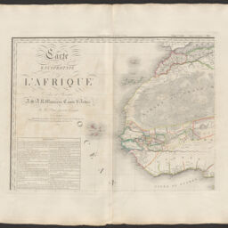
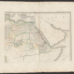
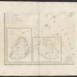
Carte Encyprotype de l'Afrique
Permalink
https://digital.library.illinois.edu/items/c70d2b80-0485-013c-47d9-02d0d7bfd6e4-b
This item is in the public domain.
Descriptive Information
| Title | Carte Encyprotype de l'Afrique |
| Creator | Brué, Adrien Hubert, 1786-1832 |
| Date | 1814 |
| Dimensions | 50 x 65 cm |
| Place of Publication | Paris (France) |
| Publisher | Desray and J. Goujon |
| Cartographic Scale | 1:11 250 000 |
| Notes | Inset maps of Ile de France and Ile Bourbon on Sheet 3. |
| Coverage-Spatial | Africa |
| Language | French |
| Physical Location | Professor Thomas Bassett Personal Collection |
| Is Referenced By | http://catalogue.bnf.fr/ark:/12148/cb40674264q |
| Map ID | AFM0003586 |
| Rights | No Copyright - United States |
| Rights Description | This item is in the public domain. |
| Collection Title | Maps of Africa to 1900 |
| Repository | Rare Book & Manuscript Library |
| Type | Cartographic material |
| Collection | Maps of Africa to 1900 |
Download Options
|
afm0003586-001 | |
|
afm0003586-002 | |
|
afm0003586-003 | |

|
afm0003586-004 |
Contact us
for questions and to provide feedback.