
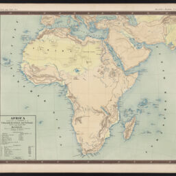
Africa
Permalink
https://digital.library.illinois.edu/items/c72b5110-0485-013c-47d9-02d0d7bfd6e4-6
This item is in the public domain.
Descriptive Information
| Title | Africa |
| Creator | Ewald, Ludwig (1813-1881) |
| Contributor | Bauerkeller, Georg Leonhart |
| Date | 1850 |
| Dimensions | 35 x 42 cm |
| Place of Publication | Darmstadt (Germany) |
| Publisher | Jonghaus & Venator's Kartogr. Anstalt |
| Cartographic Scale | 1:28,800,000 |
| Notes | From Bauerkeller's Handatlas der Allgemeinen Erdkunde, Laender- und Staatenkunde, Pl. no 30. ; Rumsey No. 12189.052. |
| Coverage-Spatial | Africa |
| Language | German |
| Physical Location | Professor Thomas Bassett Personal Collection |
| Map ID | AFM0003591 |
| Rights | No Copyright - United States |
| Rights Description | This item is in the public domain. |
| Collection Title | Maps of Africa to 1900 |
| Repository | Rare Book & Manuscript Library |
| Type | Cartographic material |
| Collection | Maps of Africa to 1900 |
Download Options
Contact us
for questions and to provide feedback.