
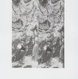
Stereogram No. 101 - Devil's Tower
101
Permalink
https://digital.library.illinois.edu/items/eb9d4480-8a10-0137-6d99-02d0d7bfd6e4-0
Instructors are encouraged to download and print the images for classroom or laboratory instructional use. Please contact the Map Library with questions regarding reproduction for publication via e-mail (http://www.library.illinois.edu/mailform/mail.php?emailcode=mapandgeog) or by calling 217-333-0827.
Descriptive Information
| Title | Stereogram No. 101 - Devil's Tower |
| Photo Number | 101 |
| Prepared From | USDA-AAA (BBU-32-96,97) |
| County | Crook County (Wyo.) |
| Country | United States |
| State | Wyoming |
| Subject | Miscellaneous |
| Date | 1938-08-29 |
| Scale | 1:24,000 |
| Medium | Puer XX (Nitrate) |
| Map Ref. | Devil's Tower 15' |
| Page in Index Book | A-1-1 |
| Rights | In Copyright - Educational Use Permitted |
| Rights Description | Instructors are encouraged to download and print the images for classroom or laboratory instructional use. Please contact the Map Library with questions regarding reproduction for publication via e-mail (http://www.library.illinois.edu/mailform/mail.php?emailcode=mapandgeog) or by calling 217-333-0827. |
| Type | Still image |
| Repository | Map Library |
| Collection Title | Aerial Stereograms |
| Collection | Aerial Stereograms |
Download Options
|
Stereogram No. 101 - Devil's Tower |
Contact us
for questions and to provide feedback.