


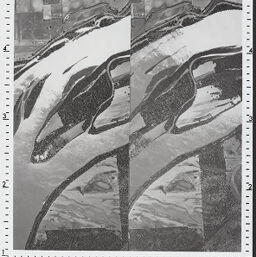
Stereogram No. 429 - Boyd Island
429
Permalink
https://digital.library.illinois.edu/items/edb25d50-8a10-0137-6d99-02d0d7bfd6e4-0
Instructors are encouraged to download and print the images for classroom or laboratory instructional use. Please contact the Map Library with questions regarding reproduction for publication via e-mail (http://www.library.illinois.edu/mailform/mail.php?emailcode=mapandgeog) or by calling 217-333-0827.
Descriptive Information
| Title | Stereogram No. 429 - Boyd Island |
| Photo Number | 429 |
| Prepared From | USDA-PMA (AR-2G-206,207) |
| County | Pike County (Ill.) |
| Country | United States |
| State | |
| Subject | Soils |
| Date | 1950-06-05 |
| Scale | 1:20,950 |
| Medium | Panchromatic |
| Map Ref. | Barry 15' (T6S,R6W,Sec.22:T55N,R2W,Sec.23) |
| Page in Index Book | A-4-10 |
| Rights | In Copyright - Educational Use Permitted |
| Rights Description | Instructors are encouraged to download and print the images for classroom or laboratory instructional use. Please contact the Map Library with questions regarding reproduction for publication via e-mail (http://www.library.illinois.edu/mailform/mail.php?emailcode=mapandgeog) or by calling 217-333-0827. |
| Type | Still image |
| Repository | Map Library |
| Collection Title | Aerial Stereograms |
| Collection | Aerial Stereograms |
Download Options
|
Stereogram No. 429 - Boyd Island |
Contact us
for questions and to provide feedback.