
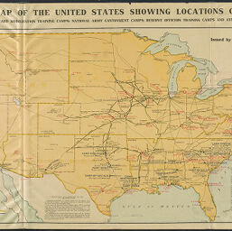
Map of the United States showing locations of National Guard mobilization training camps, national army cantonment camps, reserve officers training camps and aviation sites
Putting the United States Army on the map
Permalink
https://digital.library.illinois.edu/items/ef39d480-17c7-0137-6b56-02d0d7bfd6e4-1
No Copyright - United States
Descriptive Information
| Title | Map of the United States showing locations of National Guard mobilization training camps, national army cantonment camps, reserve officers training camps and aviation sites |
| Alternative Title | Putting the United States Army on the map |
| Creator | Rand McNally and Company |
| Contributor | Chicago, Rock Island & Pacific Rail Road Co. |
| Place of Publication | Chicago (Ill.) |
| Publisher | Rand McNally and Company |
| Date of Publication | 1918 |
| Extent | 1 map, col. |
| Dimensions | 49 x 91 cm |
| Notes |
|
| Coverage-Spatial | United States |
| Language | English |
| Genre | Maps |
| Rights Description | No Copyright - United States |
| Type | Cartographic material |
| Repository | Map Library |
| Local Bib ID | 1621972 |
| Collection Title | World War I Maps |
| Collection | World War I Maps |
Download Options
|
Map of the United States showing locations of National Guard mobilization training camps, national army cantonment camps, reserve officers training camps and aviation sites |
Contact us
for questions and to provide feedback.