
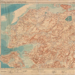
Topographische karte des westlichen Kleinasien
Permalink
https://digital.library.illinois.edu/items/efe186d0-17c7-0137-6b56-02d0d7bfd6e4-3
No Copyright - United States
Descriptive Information
| Title | Topographische karte des westlichen Kleinasien |
| Creator | Philippson, Alfred, 1864-1953 |
| Scale | Scale 1:300,000. |
| Place of Publication | Gotha (Germany) |
| Publisher | Justus Perthes (Firm : Gotha, Germany) |
| Date of Publication | 1910-1913 |
| Extent | 6 maps, color |
| Dimensions | 61 x 72 cm or smaller |
| Notes |
|
| Coverage-Spatial | Turkey |
| Language | German |
| Genre | Topographic maps |
| Rights Description | No Copyright - United States |
| Type | Cartographic material |
| Repository | Map Library |
| Local Bib ID | 4002213 |
| Collection Title | World War I Maps |
| Collection | World War I Maps |
Download Options
|
4001827-001 | |

|
4001827-002 |
Contact us
for questions and to provide feedback.