
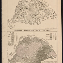
Hungary
Hungary, population density in 1910
Permalink
https://digital.library.illinois.edu/items/f01baa60-17c7-0137-6b56-02d0d7bfd6e4-5
No Copyright - United States
Descriptive Information
| Title | Hungary |
| Alternative Title |
|
| Creator | Wallis, B. C.(Bertie Cotterell) |
| Scale | Scale 1:8,250,000 |
| Place of Publication | New York (N.Y.) |
| Publisher | American Geographical Society of New York |
| Date of Publication | 1917 |
| Extent | 2 maps on 1 sheet |
| Dimensions | both 10 x 12 cm, sheet 21 x 14 cm |
| Notes |
|
| Coverage-Spatial | Hungary |
| Language | English |
| Subject | |
| Genre | Maps |
| Rights Description | No Copyright - United States |
| Type | Cartographic material |
| Repository | Map Library |
| Local Bib ID | 7662648 |
| Collection Title | World War I Maps |
| Collection | World War I Maps |
Download Options
|
Hungary |
Contact us
for questions and to provide feedback.