
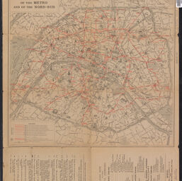
Map of Paris, of the metro, and of the Nord-Sud
Map of the touristic regions of France
Permalink
https://digital.library.illinois.edu/items/f0297270-17c7-0137-6b56-02d0d7bfd6e4-b
No Copyright - United States
Descriptive Information
| Title | Map of Paris, of the metro, and of the Nord-Sud |
| Alternative Title | Map of the touristic regions of France |
| Creator | France. Office national du tourisme |
| Contributor | Charbey, H. |
| Place of Publication | Paris (France) |
| Publisher | France. Office national du tourisme |
| Date of Publication | 1918 |
| Extent | 2 maps, both sides, color |
| Dimensions | 41 x 43 cm and 44 x 42 cm, on sheet 47 x 58 cm, folded to 24 x 15 cm |
| Notes |
|
| Coverage-Spatial | |
| Language | English |
| Genre | |
| Rights Description | No Copyright - United States |
| Type | Cartographic material |
| Repository | Map Library |
| Local Bib ID | 7663235 |
| Collection Title | World War I Maps |
| Collection | World War I Maps |
Download Options
|
Map of Paris, of the metro, and of the Nord-Sud |
Contact us
for questions and to provide feedback.