
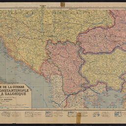
Carte générale de la guerre
Permalink
https://digital.library.illinois.edu/items/f02fb5d0-17c7-0137-6b56-02d0d7bfd6e4-f
No Copyright - United States
Descriptive Information
| Title | Carte générale de la guerre |
| Creator | Editions Blondel La Rougery |
| Scale | Scale approximately 1:1,900,000 |
| Coordinates | (E 10°--E 31°/N 48°--N 39°) |
| Place of Publication | Paris (France) |
| Publisher | Éditions Blondel La Rougery |
| Date of Publication | 1916 |
| Extent | 1 map, color |
| Dimensions | 45 x 84 cm |
| Notes |
|
| Coverage-Spatial | Balkan Peninsula |
| Language | French |
| Genre | Military maps |
| Rights Description | No Copyright - United States |
| Type | Cartographic material |
| Repository | Map Library |
| Local Bib ID | 7663504 |
| Collection Title | World War I Maps |
| Collection | World War I Maps |
Download Options
|
Carte générale de la guerre |
Contact us
for questions and to provide feedback.