
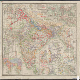
June 1914 map of railway systems in India, Burma, and Ceylon
Map of railway systems in India, Burma, and Ceylon
Permalink
https://digital.library.illinois.edu/items/f035e880-17c7-0137-6b56-02d0d7bfd6e4-e
No Copyright - United States
Descriptive Information
| Title | June 1914 map of railway systems in India, Burma, and Ceylon |
| Alternative Title | Map of railway systems in India, Burma, and Ceylon |
| Creator | Trott, J. H. |
| Scale | Scale 1:4,055,040. |
| Place of Publication | Simla (India) |
| Publisher | India. Railway Board |
| Date of Publication | 1914 |
| Extent | 1 map, color |
| Dimensions | 84 x 87 cm |
| Notes |
|
| Coverage-Spatial | |
| Language | English |
| Genre | Thematic maps |
| Rights Description | No Copyright - United States |
| Type | Cartographic material |
| Repository | Map Library |
| Local Bib ID | 7664970 |
| Collection Title | World War I Maps |
| Collection | World War I Maps |
Download Options
|
June 1914 map of railway systems in India, Burma, and Ceylon |
Contact us
for questions and to provide feedback.