
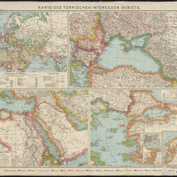
Karte des türkischen Interessen-Gebiets
Flemmings Karte für das tűrkische Interessengebiet
Permalink
https://digital.library.illinois.edu/items/f046c740-17c7-0137-6b56-02d0d7bfd6e4-4
No Copyright - United States
Descriptive Information
| Title | Karte des türkischen Interessen-Gebiets |
| Alternative Title |
|
| Creator | Carl Flemming (Firm) |
| Contributor | Kettler, J. I. |
| Scale | Scales differ |
| Place of Publication |
|
| Publisher | Carl Flemming (Firm) |
| Date of Publication | 1914 |
| Extent | 4 maps on 1 sheet, color |
| Dimensions | 31 x 48 cm or smaller, on sheet 71 x 87 cm |
| Notes |
|
| Coverage-Spatial | |
| Language | German |
| Genre | Maps |
| Rights Description | No Copyright - United States |
| Type | Cartographic material |
| Repository | Map Library |
| Local Bib ID | 7666745 |
| Collection Title | World War I Maps |
| Collection | World War I Maps |
Download Options
|
Karte des türkischen Interessen-Gebiets |
Contact us
for questions and to provide feedback.