
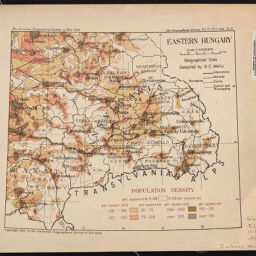
Hungary, population density
Permalink
https://digital.library.illinois.edu/items/f0579f70-17c7-0137-6b56-02d0d7bfd6e4-0
No Copyright - United States
Descriptive Information
| Title | Hungary, population density |
| Creator | American Geographical Society of New York |
| Contributor | Wallis, B. C. |
| Scale | Scale 1:2,000,000 |
| Coordinates | (E 15°35'--E 27°00'/N 50°00'--N 44°00') |
| Place of Publication | New York (N.Y.) |
| Publisher | American Geographical Society of New York |
| Date of Publication | 1918 |
| Extent | 4 maps, color |
| Dimensions | 20 x 30 cm or smaller, on sheets 25 x 37 cm or smaller |
| Notes |
|
| Coverage-Spatial | |
| Language | English |
| Genre | Thematic maps |
| Rights Description | No Copyright - United States |
| Type | Cartographic material |
| Repository | Map Library |
| Local Bib ID | 7669092 |
| Collection Title | World War I Maps |
| Collection | World War I Maps |
Download Options
|
7669092-001 | |

|
7669092-002 | |

|
7669092-003 | |

|
7669092-004 |
Contact us
for questions and to provide feedback.