
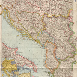
Österreichisch-ungarisch=serbischer Kriegsschauplatz
Permalink
https://digital.library.illinois.edu/items/f05a83b0-17c7-0137-6b56-02d0d7bfd6e4-f
No Copyright - United States
Descriptive Information
| Title | Österreichisch-ungarisch=serbischer Kriegsschauplatz |
| Creator | Justus Perthes (Firm : Gotha, Germany) |
| Contributor | Langhans, Paul |
| Scale | Scale 1:10,000,000 |
| Coordinates | (E 13°--E 24°/N 47°--N 39°) |
| Place of Publication | Gotha (Germany) |
| Publisher | Justus Perthes (Firm : Gotha, Germany) |
| Date of Publication | |
| Extent | 1 map, color |
| Dimensions | 81 x 74 cm |
| Notes |
|
| Coverage-Spatial | |
| Language | German |
| Genre | Thematic maps |
| Rights Description | No Copyright - United States |
| Type | Cartographic material |
| Repository | Map Library |
| Local Bib ID | 7669468 |
| Collection Title | World War I Maps |
| Collection | World War I Maps |
Download Options
|
Österreichisch-ungarisch=serbischer Kriegsschauplatz |
Contact us
for questions and to provide feedback.